
 24 km/h
 20 %
20 %


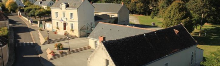
Introduction to the village
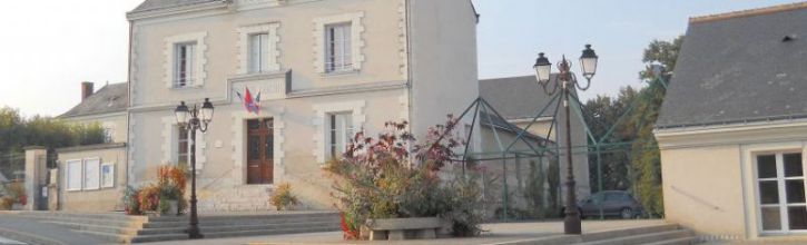
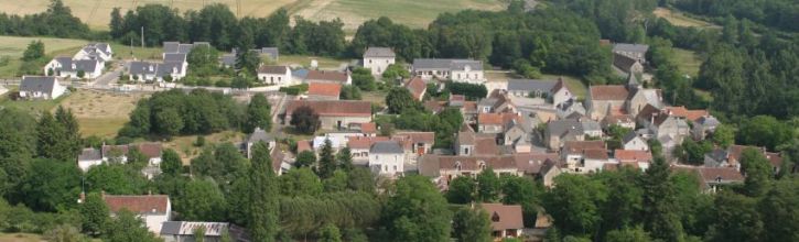
Epeigné les Bois is a rural village which is part of the administrative district of Bléré. It is situated to the east of the Indre and Loire department, bordering the Loir and Cher department, 12 km from Bléré and 39 km from Tours.
Set back from the valley of the river Cher, the village is cut in two (from South to North) by the Chézelle stream, a tributary of the left side of the river Cher. The centre of the village is grouped around the church on the left bank of the stream, on a gentle slope.
Wrapped around an undulating countryside, the village is a green and leafy stop on the route to the chateaux of Montpoupon (4 km) and Chenonceau (9km).
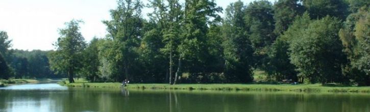
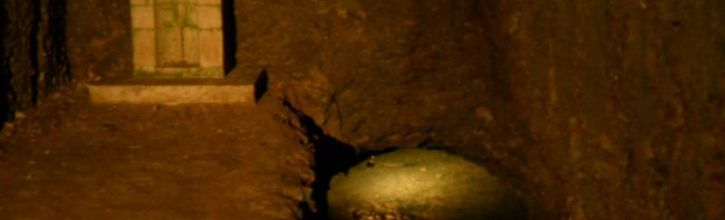
At the foot of the church, a staircase gives access to a cave containing a spring to which healing virtues have been attributed. All this is located under the apse of the church. At the bottom of the village, in a tree-filled setting, a lake provides a tourist attraction in the valley of the Chézelle stream. The whole forms a remarkable rural setting.
- Population : 440 (2014 figures)
- Names of inhabitants : Epeignois (M)/ Epeignoises (F)
- Population density : 30 habitants per square kilometre
- Area of the village : 14.52 square kilometers
- Lowest altitude : La Ronde 74 metres above sea-level
- Highest altitude : la Pierre Debout 141 metres above sea-level
- Working population : 140 (1999 figures)
- Administrative district : canton of Bléré, the village is part of a grouping with other villages/towns forming the Communauté de communes Bléré Val-de-Cher
- Administrative division : Tours
- Département : Indre and Loire
- Région : Centre
History
Épeigné-les-Bois is mention in 816 under the name of SPANIACUS in a certificate of Louis Le Débonnaire. Forming a stronghold of the chateau of Amboise, this parish belonged to the abbey of Villeloin from the 9th century. This ownership was upheld in 1070 by Foulques Réchin and in 1253 by Pope Innocent IV.
The abbey of Villeloin founded a priory in Épeigné, the prior held the title of Lord of Épeigné.
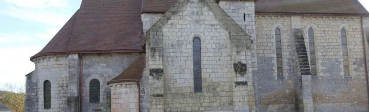
The church
The western face of the church was restored in recent times, a window in three sections was added with the middle window higher than the two outside windows.
The 13th century nave is divided in two square rows, the vaulted ceiling is in six parts like the church of Nouans-les-Fontaines which is its contemporary. The rib vaults finish in half columns. Each row of the church receives light from a single arched window on the northern wall of the church.
The nave leads to a transept where the square and meridian crosspiece have been vaulted on intersected rib vaults. The northern crosspiece is the oldest, dating from the 12th century and has kept its barrel vault.
In the semi-circular absidiole one can see a Virgin Mary dating from the 16th century and two other statues whose origins are, without doubt, from former tombs.
The chancel, in two rows, has a lightly indented barrel vault and is separated by a large transverse arch in square sections without mouldings. The arch, as well as the semi-circular absidiole vaulted in a half coupole which finishes the church, date from the 12th century.
The spring of Saint Aignan
Under the church the rock has been dug out into a cave which was used as a chapel dedicated to St Aignan and containing a spring. This cave was without doubt devoted to a pagan cult prior to the establishment of the church.
Religious processions to the source took place until the 1950’s. A mass for St Aignan was celebrated and the congregation descended down to the spring. The water has healing properties. It treats among other things "cradle cap" in babies. To this day people visit to take the water for healing purposes.
To the south of the church the priory buildings dating from the 15th century remain, but they have since been modified.
Chossay
The name Chossay is of Roman origin and derives from the Roman word Cauciacum which gives an idea of the antiquity of the place, it features on Cassini’s map under the name Chossé. In the records of Villeloin there is a charter of 5th June 1284 in which 27 inhabitants of Epeigné named prosecutors in an action against some monks. Seven amonst the inhabitants had the name of Chocé and one of the prosecutors was called Guillaume of Chocé.
Before the French Revolution Chossay was a stronghold. It was subsequently divided amongst several owners around 1820. Entry to the hamlet is via two stone pillars framing a gate which has long disappeared. The date of 1720 marked on one of the pillars is no longer visible.
The master's house has a Mansart style roof. The house is prolonged by a former servant’s building which has a rounded gable end.
The south face has been modified and shows some walled former doorways. A staircase in stone gives access to the ground floor. A half-timbered corridor serves the rooms. In another corridor there is an inscription with the date 1797.
The small wing to the north contains a bread oven. There are traces of two other bread ovens, The communal well (35m deep), sheltered in another building is remarkable. Its winch has a large wooden wheel.
House in the centre of the village
At the side of the church you will find a house dating from the 19th century with a roof in the " Imperial" style. This is a roof in the form of a curved dome, reminiscent of an emperor’s crown. The roof tiles are cut in the shape of scales. The village bought and restored the house to provide two rented properties.
Walks
Chossay walk
9km
You overlook the valley of the Chézelle stream. You will see the perspective of the valley of the river Cher and the forest of Amboise. You will view the manor house of Chossay, seat of an ancient stronghold which was split up during the modern era. A pillar at the entry gate bore the date 1720, but this is no longer visible. In 1879 there were 28 inhabitants of this hamlet. Next you will find yourself in a secret pathway. The return is made by a footbridge which crosses the Chézelle stream in front of the watermill of the centre of the village.
Bellevue walk
10km
This walk leads you through the woods, you exit on the Bellevue plain which well deserves its name. You will discover the vast panorama of the Cher valley. The return is made through the woods of Montpoupon to rejoin the valley by the Coulée du Gué a forded stream which runs into the Chézelle stream. You can cross the stream by a ford or footbridge. You then pass close to the watermill of Foulon, one of the three watermills of the village.
Montpoupon walk
12km
This magnificent walk brings you through the vineyards. From far away you can see “La Ronde de Céré”,the highest point in the department (188 metres above sea-level). On leaving the woods you will discover the chateau of Montpoupon in its pastoral setting. The return to Epeigné is made along the Chézelle stream. You can cross the stream by a ford or footbridge (Le Gué au Maître).
Lake
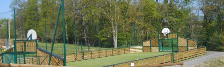
Our lake welcomes anglers and walkers. Picnic tables, a fitness trail and a children’s playground are provided for your use.
Fishing is permitted on Monday, Wednesday, Friday, Saturday, Sunday and on Public Holidays (except all day on 13th July and on the morning of 14th July) between the following dates and times :
- From the 1st of May to the 1st of November
- From 30 minutes before sunrise to 30 minutes after sunset
Fishing permits can be bought at the lake from the attendant.